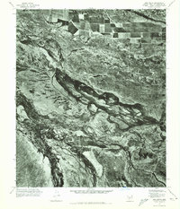
1971 Map of Pima Butte
USGS Topo · Published 1972About this map
Agricultural development and natural hydrology intersect in this 1971 orthophotomap of the Arizona desert. The Gila River dominates the central landscape, showing a complex braided channel system that reflects the seasonal flow patterns of the region. To the north, the structured grid of irrigated fields belonging to Lone Butte Ranch provides a sharp contrast to the surrounding arid terrain. The map also records the confluence of the Vekol Wash as it approaches the river valley from the south. Rising above the lowlands, the prominent landform of Pima Butte serves as a primary geographic anchor for the quadrangle. This aerial perspective captures the specific footprint of desert ranching and water management during the early 1970s.
Find a feature on this map
4 named features on this map. Tap any name to fly to it.
Don’t see what you’re looking for? This feature index may not catch every label — zoom into the map to look around manually.
Map Details
Editions of this 1971 Pima Butte Map
This is the sole edition of this map. No revisions or reprints were ever made.
Other maps of this area

1912 · Phoenix
USGS Topo · 1:62,500

1913 · Mesa
USGS Topo · 1:62,500

1913 · Maricopa
USGS Topo · 1:62,500

1914 · Gila Butte
USGS Topo · 1:62,500

1914 · Phoenix
USGS Topo · 1:62,500

1915 · Mesa
USGS Topo · 1:62,500

1915 · Maricopa
USGS Topo · 1:62,500

1917 · Gila Butte
USGS Topo · 1:62,500

1952 · Maricopa
USGS Topo · 1:24,000

1952 · Sacaton Butte
USGS Topo · 1:24,000