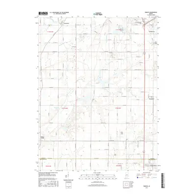
2016 Map of Pimento
USGS Topo · Published 2016About this map
Prairieton and the surrounding agricultural landscapes of Vigo and Sullivan counties are defined by a network of drainage ditches and slow-moving waterways that shaped early settlement. This part of Indiana features a high concentration of private landing strips, including Aero Plaines Airport, Kester Fly Inn Airport, and Shure Airport, reflecting the region's aviation heritage. Local history is anchored by established communities like Pimento and Youngstown, with the southern edge of the survey reaching the township of Farmersburg. Genealogy researchers can find legacy landmarks such as Kester Cem and Union Cem near the creek systems. The natural landscape is dominated by the Hayworth Slough and the winding Prairie Cr, while engineering works like McFarland Ditch illustrate the long-term management of the local floodplain to support the area's rich farming traditions.
Find a feature on this map
105 named features on this map. Tap any name to fly to it.
Don’t see what you’re looking for? This feature index may not catch every label — zoom into the map to look around manually.
Map Details
Editions of this 2016 Pimento Map
This is the sole edition of this map. No revisions or reprints were ever made.
Other maps of this area

1932 · Marshall
USGS Topo · 1:62,500

1937 · Marshall
USGS Topo · 1:62,500

1940 · Lewis
USGS Topo · 1:24,000

1940 · Pimento
USGS Topo · 1:24,000

1941 · Seelyville
USGS Topo · 1:24,000

1941 · Terre Haute
USGS Topo · 1:24,000

1942 · Fairbanks
USGS Topo · 1:24,000

1942 · Shelburn
USGS Topo · 1:24,000

1942 · Hutton
USGS Topo · 1:24,000

1942 · Dennison
USGS Topo · 1:24,000