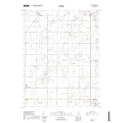
2019 Map of Pimento
USGS Topo · Published 2019About this map
Prairieton and the surrounding farm country of southern Vigo County are defined by a network of drainage ditches and slow-moving waterways like Honey Creek and McFarland Ditch. This 2019 survey captures the rural character of the landscape between Youngstown and the Sullivan County line, where long-standing community landmarks remain central to the geography. Local history is anchored by several burial grounds, including Prairieton Cem, Kester Cem, and Union Cem, as well as the First Prairie Creek Baptist Church. The topography reflects a mix of agricultural utility and recreational spaces, with the Elliott Woods Trail and Fowler Park Trails providing public access to the area's wooded pockets. Small private airstrips like Aero Plaines Airport and Shure Airport dot the fields, serving as modern identifiers for this well-established farming region.
Find a feature on this map
111 named features on this map. Tap any name to fly to it.
Don’t see what you’re looking for? This feature index may not catch every label — zoom into the map to look around manually.
Map Details
Editions of this 2019 Pimento Map
This is the sole edition of this map. No revisions or reprints were ever made.
Other maps of this area

1932 · Marshall
USGS Topo · 1:62,500

1937 · Marshall
USGS Topo · 1:62,500

1940 · Lewis
USGS Topo · 1:24,000

1940 · Pimento
USGS Topo · 1:24,000

1941 · Seelyville
USGS Topo · 1:24,000

1941 · Terre Haute
USGS Topo · 1:24,000

1942 · Fairbanks
USGS Topo · 1:24,000

1942 · Shelburn
USGS Topo · 1:24,000

1942 · Hutton
USGS Topo · 1:24,000

1942 · Dennison
USGS Topo · 1:24,000