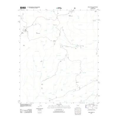
2011 Map of Pinal Ranch
USGS Topo · Published 2011About this map
Top-of-the-World and Pinal Ranch sit atop the high mountain landscape east of the Dripping Spring Mountains, where the high desert meets steep canyons and drainage basins. The area is defined by a series of high-altitude ranching outposts, including Clark Ranch and the Sixty Six Ranch, situated among prominent peaks like Signal Mountain and Hutton Peak. Water sources are vital in this arid terrain, as evidenced by the numerous named springs and tanks such as Hairpin Spring, Coyote Spring, and Simpson Lake. The topography is etched by deep cuts like Iron Canyon and Lyons Canyon, while the north is marked by the curiously named Bloody Tanks Wash. Movement through the region is guided by routes like Dripping Spring Rd, connecting remote sites like Bellevue and Hagen Ranch across a network of washes and gulches that feed into Pinto Creek.
Find a feature on this map
74 named features on this map. Tap any name to fly to it.
Don’t see what you’re looking for? This feature index may not catch every label — zoom into the map to look around manually.
Map Details
Editions of this 2011 Pinal Ranch Map
This is the sole edition of this map. No revisions or reprints were ever made.
Other maps of this area

1900 · Florence
USGS Topo · 1:125,000

1901 · Globe
USGS Topo · 1:62,500

1902 · Globe
USGS Topo · 1:62,500

1902 · Florence
USGS Topo · 1:125,000

1910 · Ray
USGS Topo · 1:62,500

1945 · Globe
USGS Topo · 1:24,000

1945 · Inspiration
USGS Topo · 1:24,000

1947 · Inspiration
USGS Topo · 1:24,000

1948 · Pinal Ranch
USGS Topo · 1:24,000

1948 · Superior
USGS Topo · 1:62,500