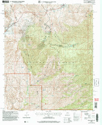
2004 Map of Pinal Ranch
USGS Topo · Published 2007About this map
The Gila and Pinal County line bisects this rugged section of the Tonto National Forest as it appeared in the early 21st century. The landscape is defined by its mining legacy and ranching heritage, notably around the Gibson Mine Prospects and the clustered family holdings of Clark Ranch and Schulze Ranch. Water, always a critical resource in this arid environment, is meticulously documented through numerous named sources such as Bloody Tanks Wash, Pinto Creek, and Simpson Lake. The presence of several prospects and a tunnel near Sunset Spring underscores the area's geological importance. While remote, the area is crisscrossed by several 4wd tracks and a prominent Telephone Line, showing how modern utility and recreational access overlaid older ranching boundaries like those near Gibson Ranch.
Find a feature on this map
45 named features on this map. Tap any name to fly to it.
Don’t see what you’re looking for? This feature index may not catch every label — zoom into the map to look around manually.
Map Details
Editions of this 2004 Pinal Ranch Map
This is the sole edition of this map. No revisions or reprints were ever made.
Other maps of this area

1900 · Florence
USGS Topo · 1:125,000

1901 · Globe
USGS Topo · 1:62,500

1902 · Globe
USGS Topo · 1:62,500

1902 · Florence
USGS Topo · 1:125,000

1910 · Ray
USGS Topo · 1:62,500

1945 · Globe
USGS Topo · 1:24,000

1945 · Inspiration
USGS Topo · 1:24,000

1947 · Inspiration
USGS Topo · 1:24,000

1948 · Pinal Ranch
USGS Topo · 1:24,000

1948 · Superior
USGS Topo · 1:62,500