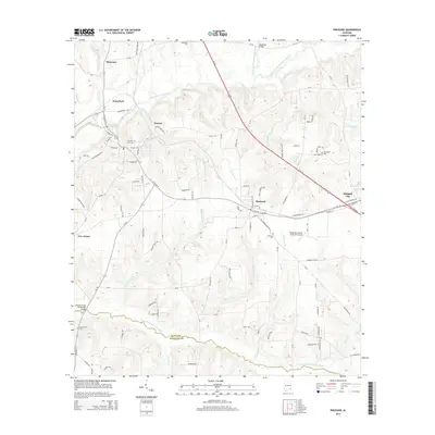
2014 Map of Pinckard
USGS Topo · Published 2014About this map
Newton and Pinckard serve as the primary hubs in this Southeast Alabama landscape, where the confluence of the Choctawhatchee River and the Little Choctawhatchee River defines the local topography. The map illustrates a transition between small-town grid patterns and the winding rural routes that follow the river bends and ridges of the Wiregrass region. Several family and community burial grounds, including Newton City Cem, Pinckard Cem, and the remote New Corinth Cem, are scattered throughout the quadrangle, offering essential location data for genealogical research. Transportation infrastructure is well-represented, from the modernized corridor of Us-231 to local river crossings like Woodham Bridge and the William Grady Stembridge Bridge. The presence of the Blessings Landing Air Ranch Airport near Pinckard highlights the integration of private aviation into this predominantly agricultural and residential area.
Find a feature on this map
111 named features on this map. Tap any name to fly to it.
Don’t see what you’re looking for? This feature index may not catch every label — zoom into the map to look around manually.
Map Details
Editions of this 2014 Pinckard Map
This is the sole edition of this map. No revisions or reprints were ever made.
Other maps of this area

1942 · Enterprise
USGS Topo · 1:125,000

1948 · Ozark
USGS Topo · 1:62,500

1950 · Ozark
USGS Topo · 1:62,500

1953 · Dothan
USGS Topo · 1:250,000

1954 · Dothan
USGS Topo · 1:250,000

1955 · Dothan
USGS Topo · 1:250,000

1957 · Malvern
USGS Topo · 1:24,000

1957 · Hartford
USGS Topo · 1:62,500
1957 · Clayhatchee
USGS Topo · 1:24,000

1960 · Ewell
USGS Topo · 1:24,000