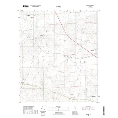
2020 Map of Pinckard
USGS Topo · Published 2020About this map
Newton and Pinckard anchor this landscape where the Choctawhatchee River and Little Choctawhatchee River converge. The terrain is defined by a dense network of tributaries including Killebrew Factory Cr, Mossy Camp Br, and Soapstone Br, which carved the winding valleys of Dale and Houston counties. Modern transportation routes such as the Old Campbellton HWY and Co RD 14 follow the historic contours of the land, connecting established communities like Midland City and Waterford.
Find a feature on this map
107 named features on this map. Tap any name to fly to it.
Don’t see what you’re looking for? This feature index may not catch every label — zoom into the map to look around manually.
Map Details
Editions of this 2020 Pinckard Map
This is the sole edition of this map. No revisions or reprints were ever made.
Other maps of this area

1942 · Enterprise
USGS Topo · 1:125,000

1948 · Ozark
USGS Topo · 1:62,500

1950 · Ozark
USGS Topo · 1:62,500

1953 · Dothan
USGS Topo · 1:250,000

1954 · Dothan
USGS Topo · 1:250,000

1955 · Dothan
USGS Topo · 1:250,000

1957 · Malvern
USGS Topo · 1:24,000

1957 · Hartford
USGS Topo · 1:62,500
1957 · Clayhatchee
USGS Topo · 1:24,000

1960 · Ewell
USGS Topo · 1:24,000