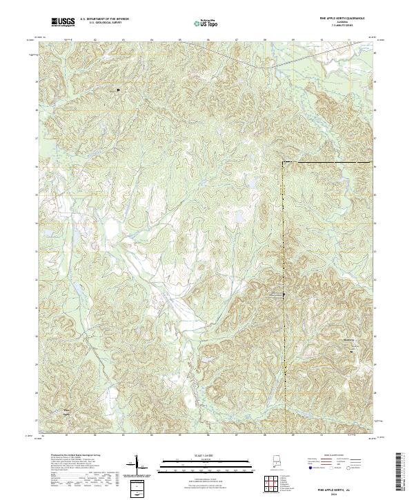
2024 Map of Pine Apple North
USGS Topo · Published 2024About this map
Pine Apple and Monterey anchor this section of Wilcox County, where the landscape is defined by an intricate network of waterways draining toward the Alabama River basin. The terrain is deeply carved by systems like Pine Barren Creek, Hills Creek, and Wolf Creek, creating a series of ridges and hollows that have historically dictated road placement and settlement patterns.
Find a feature on this map
33 named features on this map. Tap any name to fly to it.
Don’t see what you’re looking for? This feature index may not catch every label — zoom into the map to look around manually.
Map Details
Editions of this 2024 Pine Apple North Map
This is the sole edition of this map. No revisions or reprints were ever made.
Other maps of this area

1953 · Montgomery
USGS Topo · 1:250,000

1953 · Andalusia
USGS Topo · 1:250,000

1956 · Montgomery
USGS Topo · 1:250,000

1957 · Montgomery
USGS Topo · 1:250,000

1957 · Andalusia
USGS Topo · 1:250,000

1957 · Carlowville
USGS Topo · 1:62,500

1957 · Braggs
USGS Topo · 1:62,500
1981 · Oak Hill
USGS Topo · 1:24,000

1981 · Pine Apple North
USGS Topo · 1:24,000

1981 · Forest Home
USGS Topo · 1:24,000