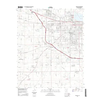
2014 Map of Pine Bluff
USGS Topo · Published 2014About this map
Pine Bluff and its surrounding communities are defined by a complex network of waterways and institutional landmarks. The city sits as a hub between the sprawling course of Bayou Bartholomew and the residential expansion of White Hall and Watson Chapel. This 2014 survey reveals a landscape with deep-rooted community foundations, evidenced by a high density of local cemeteries such as Graceland Cem, Bellwood Cem, and Saint Josephs Cem. Educational institutions like the Univ of Arkansas at Pine Bluff and Southeast Arkansas Coll anchor the northern and central portions of the city, while the southern reaches transition into more open country near Sulphur Springs and Sorrells. Smaller water bodies like Midland Lake and Lake Pine Bluff break up the urban grid, illustrating the persistent influence of the Arkansas Delta's hydrology on the area's development.
Find a feature on this map
157 named features on this map. Tap any name to fly to it.
Don’t see what you’re looking for? This feature index may not catch every label — zoom into the map to look around manually.
Map Details
Editions of this 2014 Pine Bluff Map
This is the sole edition of this map. No revisions or reprints were ever made.
Other maps of this area

1932 · Pastoria
USGS Topo · 1:62,500

1935 · Altheimer
USGS Topo · 1:62,500

1935 · Pastoria
USGS Topo · 1:62,500

1935 · Noble Lake
USGS Topo · 1:62,500

1948 · Helena
USGS Topo · 1:250,000

1950 · Helena
USGS Topo · 1:250,000

1955 · Helena
USGS Topo · 1:250,000

1955 · Little Rock
USGS Topo · 1:250,000

1956 · Little Rock
USGS Topo · 1:250,000

1959 · Helena
USGS Topo · 1:250,000