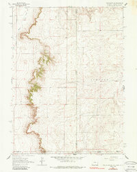
1963 Map of Pine Bluffs SE
USGS Topo · Published 1987About this map
The high plains of the tri-state border region are mapped here with precision, centering on a point where Wyoming, Nebraska, and Colorado meet. The landscape is defined by the sharp escarpment of Pine, which creates a dramatic elevation change between the tablelands to the east and the drainages of Muddy Creek and Spring Creek to the west. This 1963 survey captures the area before modern infrastructure expanded, showing a remote agricultural and ranching environment dotted with isolated water sources like Well.
Find a feature on this map
12 named features on this map. Tap any name to fly to it.
Don’t see what you’re looking for? This feature index may not catch every label — zoom into the map to look around manually.
Map Details
Editions of this 1963 Pine Bluffs SE Map
3 editions found

Other maps of this area

1954 · Sterling
USGS Topo · 1:250,000

1954 · Scottsbluff
USGS Topo · 1:250,000

1954 · Cheyenne
USGS Topo · 1:250,000

1954 · Greeley
USGS Topo · 1:250,000

1957 · Greeley
USGS Topo · 1:250,000

1958 · Cheyenne
USGS Topo · 1:250,000

1958 · Greeley
USGS Topo · 1:250,000

1958 · Scottsbluff
USGS Topo · 1:250,000

1958 · Sterling
USGS Topo · 1:250,000

1961 · Greeley
USGS Topo · 1:250,000