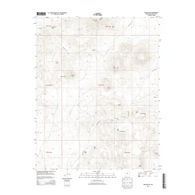
2013 Map of Pine Buttes
USGS Topo · Published 2013About this map
Trujillo and the nearby settlements of Martinez and Barela anchor this high-altitude landscape in Colfax County. The terrain is defined by dramatic volcanic and erosional features, most notably Laughlin Peak and the unique formation known as The Crater. The presence of established ranching-era locales like El Rancho Grande suggests a history of cattle or sheep operations typical of the High Plains transition.
Find a feature on this map
43 named features on this map. Tap any name to fly to it.
Don’t see what you’re looking for? This feature index may not catch every label — zoom into the map to look around manually.
Map Details
Editions of this 2013 Pine Buttes Map
This is the sole edition of this map. No revisions or reprints were ever made.
Other maps of this area

1954 · Raton
USGS Topo · 1:250,000

1958 · Raton
USGS Topo · 1:250,000

1965 · Sauble Circle Dot Ranch
USGS Topo · 1:24,000

1971 · Kiowa
USGS Topo · 1:24,000

1971 · Tres Hermanos Peak
USGS Topo · 1:24,000

1971 · Pine Buttes
USGS Topo · 1:24,000
1971 · Tinaja Mountain
USGS Topo · 1:24,000

1971 · Palo Blanco Mountain
USGS Topo · 1:24,000
1971 · Mesa Larga
USGS Topo · 1:24,000

1974 · Point Of Rocks Mesa
USGS Topo · 1:24,000