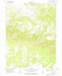
1972 Map of Pine Canyon
USGS Topo · Published 1976About this map
Whitmore Park and the surrounding highlands of Carbon County define this 1970s landscape, where natural resource extraction and rugged terrain intersect. The map documents an industrial presence through features like a Mine, various Prospects, and several Drill Hole sites scattered across the ridges. A complex network of drainage systems, including Nine Mile Creek, Soldier Creek, and Dugout Creek, carves through the canyons, while a prominent Pipeline traverses the northern section. To the south, the terrain opens into Clark Valley, illustrating the sharp transition from the plateau’s deep canyons to the broader valley floor. This survey records the early 1970s configuration of access routes and Jeep Trails that served local ranching and mining interests before later developments in the region.
Find a feature on this map
15 named features on this map. Tap any name to fly to it.
Don’t see what you’re looking for? This feature index may not catch every label — zoom into the map to look around manually.
Map Details
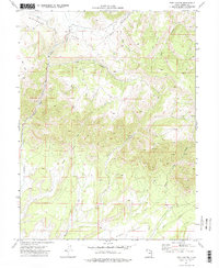
Editions of this 1972 Pine Canyon Map
2 editions found
Other maps of this area

1886 · Price River
USGS Topo · 1:250,000

1896 · Price River
USGS Topo · 1:250,000

1915 · Sunnyside
USGS Topo · 1:62,500

1915 · Wellington
USGS Topo · 1:62,500

1956 · Price
USGS Topo · 1:250,000

1960 · Price
USGS Topo · 1:250,000

1962 · Price
USGS Topo · 1:250,000

1968 · Wood Canyon
USGS Topo · 1:24,000
1969 · Minnie Maud Creek East
USGS Topo · 1:24,000
1969 · Minnie Maud Creek West
USGS Topo · 1:24,000