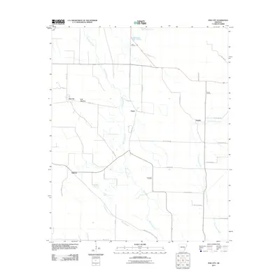
2011 Map of Pine City
USGS Topo · Published 2011About this map
Pine City and B B Junction anchor the western edge of this Monroe County landscape, characterized by a network of drainage systems and rural crossroads. The geography is defined by the slow southward flow of Big Cypress Creek and its tributary, Givins Branch, which carve through the delta terrain alongside Little Cypress Creek to the east. These waterways dictate the placement of local thoroughfares such as Pine City Rd and Palmer Rd. Smaller community nodes like Palmer, Postelle, and Ragtown are interspersed throughout the agricultural fields, often centered around family or church landmarks. Genealogists will find several significant burial sites documented here, including Union Cemetery in the north and Saint Marks Cemetery near the center of the quadrangle. The map also traces a dense grid of numbered secondary routes, such as Phillips Road 600 and County Rd 862, which reflect the modern rural infrastructure of the early 21st century.
Find a feature on this map
31 named features on this map. Tap any name to fly to it.
Don’t see what you’re looking for? This feature index may not catch every label — zoom into the map to look around manually.
Map Details
Editions of this 2011 Pine City Map
This is the sole edition of this map. No revisions or reprints were ever made.
Other maps of this area

1939 · Modoc
USGS Topo · 1:62,500

1939 · Indian Bay
USGS Topo · 1:62,500

1940 · Marvell
USGS Topo · 1:62,500

1940 · Holly Grove
USGS Topo · 1:62,500

1948 · Helena
USGS Topo · 1:250,000

1948 · Modoc
USGS Topo · 1:62,500

1950 · Helena
USGS Topo · 1:250,000

1954 · Indian Bay
USGS Topo · 1:62,500

1955 · Helena
USGS Topo · 1:250,000

1956 · Marvell
USGS Topo · 1:62,500