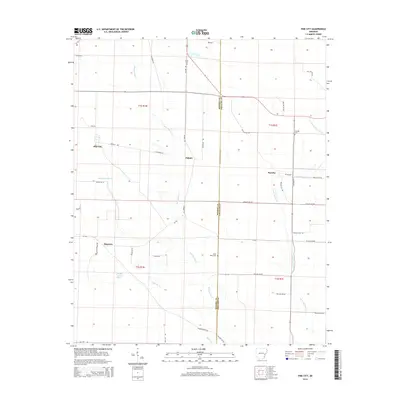
2014 Map of Pine City
USGS Topo · Published 2014About this map
The lowland bottomlands of the Monroe and Phillips border are defined by intricate drainage systems and scattered rural settlements. Small communities like Pine City, Palmer, and Postelle are interconnected by a grid of county roads and historic tracks such as E Railroad Ln. The landscape is dominated by the presence of large wetlands and seasonally flooded areas, including Persimmon Slash and Walker Cypress Slash, which reflect the hydrology of the Arkansas Delta before modern intensive modification. Local history is anchored by several burial grounds serving these rural outposts, including Union Cem, Saint Marks Cem, and Franklin Cemetery. The meandering courses of Big Cypress Cr and Little Cypress Creek further shape the geography, illustrating the challenges of settlement and agriculture in this riverine environment during the early 21st century.
Find a feature on this map
47 named features on this map. Tap any name to fly to it.
Don’t see what you’re looking for? This feature index may not catch every label — zoom into the map to look around manually.
Map Details
Editions of this 2014 Pine City Map
This is the sole edition of this map. No revisions or reprints were ever made.
Other maps of this area

1939 · Modoc
USGS Topo · 1:62,500

1939 · Indian Bay
USGS Topo · 1:62,500

1940 · Marvell
USGS Topo · 1:62,500

1940 · Holly Grove
USGS Topo · 1:62,500

1948 · Helena
USGS Topo · 1:250,000

1948 · Modoc
USGS Topo · 1:62,500

1950 · Helena
USGS Topo · 1:250,000

1954 · Indian Bay
USGS Topo · 1:62,500

1955 · Helena
USGS Topo · 1:250,000

1956 · Marvell
USGS Topo · 1:62,500