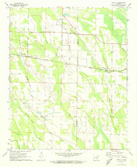
1971 Map of Pine City
USGS Topo · Published 1973About this map
Big Cypress Creek and its complex network of slashes and branches dominate this Delta landscape at the Monroe and Phillips county line. The Missouri Pacific railroad cuts a straight east-west line through the region, connecting the small trackside communities of Palmer, Postelle, and BB Junction. The presence of an old railroad grade running north from Pine City suggests a shift in the local timber or agricultural transport network during the mid-20th century.
Find a feature on this map
23 named features on this map. Tap any name to fly to it.
Don’t see what you’re looking for? This feature index may not catch every label — zoom into the map to look around manually.
Map Details
Editions of this 1971 Pine City Map
This is the sole edition of this map. No revisions or reprints were ever made.
Other maps of this area

1939 · Modoc
USGS Topo · 1:62,500

1939 · Indian Bay
USGS Topo · 1:62,500

1940 · Marvell
USGS Topo · 1:62,500

1940 · Holly Grove
USGS Topo · 1:62,500

1948 · Helena
USGS Topo · 1:250,000

1948 · Modoc
USGS Topo · 1:62,500

1950 · Helena
USGS Topo · 1:250,000

1954 · Indian Bay
USGS Topo · 1:62,500

1955 · Helena
USGS Topo · 1:250,000

1956 · Marvell
USGS Topo · 1:62,500