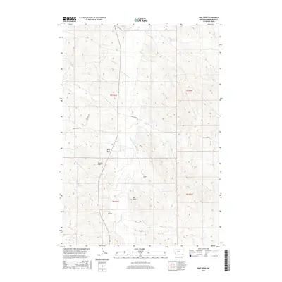
2017 Map of Pine Creek
USGS Topo · Published 2017About this map
Biddle anchors this landscape in southeastern Powder River County, where the Little Powder River winds northward through a network of intricate drainages. The topography is defined by distinctive erosion patterns, including Wolf Ravine, Preacher Draw, and Big Gulch, illustrating the transition from flat river bottom to the high plains. Landowners and researchers can trace the historic land divisions across township boundaries like t7s r52e and t8s r53e. Notable high points such as Rocky Butte and the landmark known as Bell Tower provide significant navigational anchors in an area where local travel follows named corridors like Baking Powder Rd and Bear Skull Rd. Numerous ephemeral creeks, including Wright Cr and Belle Cr, show the critical water distribution that has shaped the region's ranching history.
Find a feature on this map
31 named features on this map. Tap any name to fly to it.
Don’t see what you’re looking for? This feature index may not catch every label — zoom into the map to look around manually.
Map Details
Editions of this 2017 Pine Creek Map
This is the sole edition of this map. No revisions or reprints were ever made.
Other maps of this area

1954 · Ekalaka
USGS Topo · 1:250,000

1956 · Ekalaka
USGS Topo · 1:250,000

1958 · Ekalaka
USGS Topo · 1:250,000

1965 · Ekalaka
USGS Topo · 1:250,000

1970 · Pine Creek
USGS Topo · 1:24,000

1970 · Sanburn Reservoir
USGS Topo · 1:24,000

1970 · Wild Bill Creek
USGS Topo · 1:24,000

1970 · Belle Creek SW
USGS Topo · 1:24,000
1970 · Biddle
USGS Topo · 1:24,000

1970 · Bear Skull Mountain
USGS Topo · 1:24,000