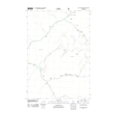
2011 Map of Pine Creek Rapids
USGS Topo · Published 2011About this map
Salmon River canyons and high mountain ridges define this stretch of Lemhi County, where the landscape is marked by a legacy of early 20th-century lode mining. Several historic operations are located in the northern reaches, including the Kentucky Mine, Grunter Mine, and the clustered Gold Hill Mine and Clipper Bullion Mine. This terrain is deeply carved by numerous gulches like Cohen Gulch and Halfway Gulch, while Copper Mountain dominates the eastern interior.
Find a feature on this map
42 named features on this map. Tap any name to fly to it.
Don’t see what you’re looking for? This feature index may not catch every label — zoom into the map to look around manually.
Map Details
Editions of this 2011 Pine Creek Rapids Map
This is the sole edition of this map. No revisions or reprints were ever made.
Other maps of this area

1950 · Blackbird Mtn
USGS Topo · 1:62,500

1950 · Leesburg
USGS Topo · 1:62,500

1951 · Leesburg
USGS Topo · 1:62,500

1951 · Blackbird Mtn
USGS Topo · 1:62,500

1956 · Elk City
USGS Topo · 1:250,000

1960 · Elk City
USGS Topo · 1:250,000

1960 · Ulysses Mtn
USGS Topo · 1:62,500

1960 · Shoup
USGS Topo · 1:62,500

1982 · Bighorn Crags
USGS Topo · 1:100,000
1989 · Jureano Mountain
USGS Topo · 1:24,000