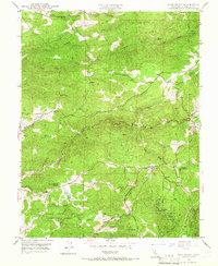
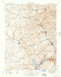
1948 Map of Pine Grove
USGS Topo · Published 1966About this map
The Jackson Indian Rancheria and the rugged drainage basins of the Mother Lode region define this late 1940s landscape. Established ranching and mining interests are scattered throughout the hills, including New York Ranch and the Fort Ann Mine. The terrain is deeply carved by a network of waterways such as Rancheria Creek, Sutter Creek, and Jackson Creek, which supported the early hydraulic and industrial needs of Amador County.
Find a feature on this map
28 named features on this map. Tap any name to fly to it.
Don’t see what you’re looking for? This feature index may not catch every label — zoom into the map to look around manually.
Map Details
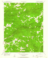
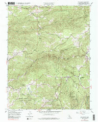
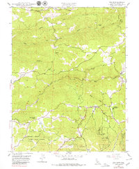
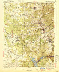
Editions of this 1948 Pine Grove Map
4 editions found
Other maps of this area

1889 · Jackson
USGS Topo · 1:125,000

1891 · Placerville
USGS Topo · 1:125,000

1892 · Jackson
USGS Topo · 1:125,000

1892 · Placerville
USGS Topo · 1:125,000

1893 · Placerville
USGS Topo · 1:125,000

1897 · Jackson
USGS Topo · 1:125,000

1902 · Jackson
USGS Topo · 1:125,000
1941 · Sutter Creek
USGS Topo · 1:62,500
1944 · Sutter Creek
USGS Topo · 1:62,500

1947 · Sacramento
USGS Topo · 1:250,000