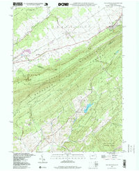
1998 Map of Pine Grove Mills
USGS Topo · Published 1999About this map
Pine Grove Mills and its surrounding agricultural valleys are the focal point of this late 20th-century survey of the Centre Co and Huntingdon Co borderlands. The landscape is defined by the massive ridge of Tussey Mountain, which separates the northern valley settlements of Fairbrook and Rockspring from the southern woodland reaches of the Rothrock State Forest. This transition from farmed valley floor to high timbered ridges reflects the region's industrial heritage, anchored by historic sites like Monroe Furnace and Neffs Mills.
Find a feature on this map
48 named features on this map. Tap any name to fly to it.
Don’t see what you’re looking for? This feature index may not catch every label — zoom into the map to look around manually.
Map Details
Editions of this 1998 Pine Grove Mills Map
This is the sole edition of this map. No revisions or reprints were ever made.
Other maps of this area

1908 · Bellefonte
USGS Topo · 1:62,500

1909 · Bellefonte
USGS Topo · 1:62,500

1919 · Menno
USGS Topo · 1:62,500

1922 · Philipsburg
USGS Topo · 1:62,500

1923 · Tyrone
USGS Topo · 1:62,500

1929 · Tyrone
USGS Topo · 1:48,000

1933 · Tyrone
USGS Topo · 1:62,500

1935 · Allensville
USGS Topo · 1:62,500

1938 · Allensville
USGS Topo · 1:62,500

1939 · Philipsburg
USGS Topo · 1:62,500