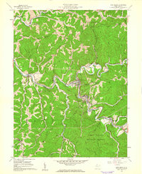
1960 Map of Pine Grove
USGS Topo · Published 1962About this map
Pine Grove serves as a central hub along the winding Fishing Creek, where the river's path is closely followed by the Baltimore and Ohio RR. This 1960 era survey reveals a landscape defined by extractive industry and rural settlement, with numerous gas wells and a Compressor Station dotting the ridges and hollows. The rugged topography of Blenn Ridge and Morgan Ridge hem in the small communities of Reader, Hastings, and Jacksonburg, each tied to the narrow corridors of the rail line and creek.
Find a feature on this map
66 named features on this map. Tap any name to fly to it.
Don’t see what you’re looking for? This feature index may not catch every label — zoom into the map to look around manually.
Map Details
Editions of this 1960 Pine Grove Map
2 editions found
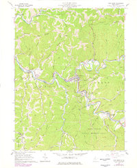
Other maps of this area

1903 · Littleton
USGS Topo · 1:62,500

1905 · Centerpoint
USGS Topo · 1:62,500

1905 · West Union
USGS Topo · 1:62,500

1905 · Littleton
USGS Topo · 1:62,500

1906 · New Martinsville
USGS Topo · 1:62,500

1924 · New Martinsville
USGS Topo · 1:62,500

1924 · Centerpoint
USGS Topo · 1:62,500

1924 · Littleton
USGS Topo · 1:62,500

1924 · West Union
USGS Topo · 1:62,500

1925 · Centerpoint
USGS Topo · 1:62,500