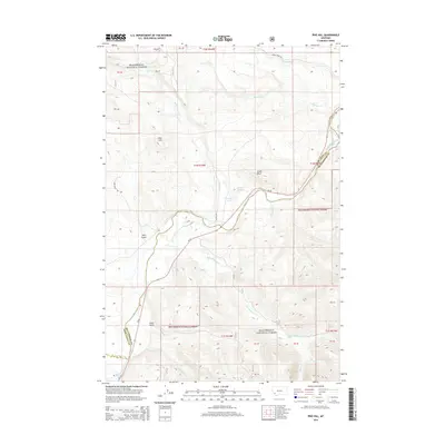
2014 Map of Pine Hill
USGS Topo · Published 2014About this map
Beaverhead National Forest land dominates this section of Southwest Montana, where the terrain is carved by a complex network of drainages and high-altitude landmarks. The northern reaches are defined by the headwaters of Stewart Creek and Mudd Creek, while the southern landscape is shaped by the canyon-like paths of Pintler Creek and Salefsky Creek. The Big Hole River cuts through the eastern portion of the map, serving as a natural boundary near the border between Deer Lodge and Beaverhead Counties. Notable elevation features like Pine Hill and the prominent Chalk Bluff overlook the valleys, providing clear points of orientation for those studying the region's topography. The map also traces local access routes such as York Gulch Drive and MT-43, which weave through the gulches and along the river flats.
Find a feature on this map
20 named features on this map. Tap any name to fly to it.
Don’t see what you’re looking for? This feature index may not catch every label — zoom into the map to look around manually.
Map Details
Editions of this 2014 Pine Hill Map
This is the sole edition of this map. No revisions or reprints were ever made.
Other maps of this area

1955 · Dillon
USGS Topo · 1:250,000

1957 · Dillon
USGS Topo · 1:250,000

1958 · Dillon
USGS Topo · 1:250,000

1962 · Dillon
USGS Topo · 1:250,000

1962 · Lower Seymour Lake
USGS Topo · 1:24,000

1962 · Mud Lake
USGS Topo · 1:24,000

1962 · Pine Hill
USGS Topo · 1:24,000
1962 · Foolhen Mountain
USGS Topo · 1:24,000

1962 · Pintlar Lake
USGS Topo · 1:24,000

1962 · Proposal Rock
USGS Topo · 1:24,000