
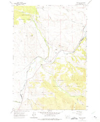
1962 Map of Pine Hill
USGS Topo · Published 1964About this map
The Big Hole River winds through this southwestern Montana landscape, serving as the county boundary between Deer Lodge and Beaverhead counties. This 1962 survey reveals a land defined by irrigation and livestock ranching, where an intricate network of water diversions like Nichols Ditch, Paddock Ditch, and the Ampo Toomey Ditch sustain the high-altitude valley. The map documents established family operations such as Bacon Ranch, Nichols Ranch, and Christianson Ranch, alongside the small settlement of Goris.
Find a feature on this map
26 named features on this map. Tap any name to fly to it.
Don’t see what you’re looking for? This feature index may not catch every label — zoom into the map to look around manually.
Map Details
Editions of this 1962 Pine Hill Map
2 editions found
Other maps of this area

1955 · Dillon
USGS Topo · 1:250,000

1957 · Dillon
USGS Topo · 1:250,000

1958 · Dillon
USGS Topo · 1:250,000

1962 · Dillon
USGS Topo · 1:250,000

1962 · Lower Seymour Lake
USGS Topo · 1:24,000

1962 · Mud Lake
USGS Topo · 1:24,000
1962 · Foolhen Mountain
USGS Topo · 1:24,000

1962 · Pintlar Lake
USGS Topo · 1:24,000

1962 · Proposal Rock
USGS Topo · 1:24,000
1962 · Long Peak
USGS Topo · 1:24,000