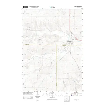
2013 Map of Pine Island
USGS Topo · Published 2013About this map
Pine Island sits at the intersection of three counties, where the North Br Middle Fork Zumbro River joins the main branch in a landscape defined by rolling drainages. This 2013 survey records a region where civil boundaries—Goodhue, Dodge, and Olmsted—converge amidst a network of rural roads and family cemeteries. These burial grounds, including Free Mission Cem and Saint Michael Cem, serve as critical markers for local genealogists tracing the area's early settlement patterns. The map highlights the town's position as a local hub, anchored by the Po and Pine Island Cem, while the surrounding terrain is carved by numerous waterways like Harkcom Cr and Plum Cr. The path of Us-52 provides a modern transit corridor through this predominantly agricultural landscape.
Find a feature on this map
49 named features on this map. Tap any name to fly to it.
Don’t see what you’re looking for? This feature index may not catch every label — zoom into the map to look around manually.
Map Details
Editions of this 2013 Pine Island Map
This is the sole edition of this map. No revisions or reprints were ever made.
Other maps of this area

1953 · Saint Paul
USGS Topo · 1:250,000

1959 · Saint Paul
USGS Topo · 1:250,000

1965 · Dodge Center
USGS Topo · 1:24,000

1965 · Concord
USGS Topo · 1:24,000

1965 · Oronoco
USGS Topo · 1:24,000

1965 · Byron
USGS Topo · 1:24,000

1965 · Pine Island
USGS Topo · 1:24,000

1966 · Douglas
USGS Topo · 1:24,000

1968 · Zumbrota
USGS Topo · 1:24,000

1968 · Mazeppa
USGS Topo · 1:24,000