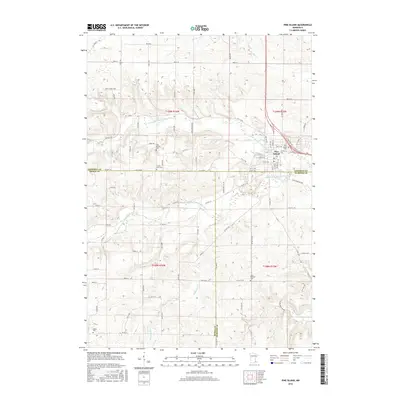
2016 Map of Pine Island
USGS Topo · Published 2016About this map
Pine Island stands at the confluence of several critical waterways, most notably the Middle Fork Zumbro River and its various branches. This 2016 survey illustrates the town's position at the intersection of Dodge, Goodhue, and Olmsted counties, a location that historically influenced its development as a regional hub. The landscape is defined by the drainage patterns of Plum Cr and Harkcom Cr, which carve through the surrounding agricultural uplands. Genealogy researchers will find significant value in the distribution of local burial sites across the township lines, including the Pine Island Cem, Saint Michael Cem, and the County Line Cem. The road network, including CO 11 Blvd and CO 27 Blvd, follows the sections established by the original land surveys, maintaining the traditional grid of the Minnesota countryside.
Find a feature on this map
92 named features on this map. Tap any name to fly to it.
Don’t see what you’re looking for? This feature index may not catch every label — zoom into the map to look around manually.
Map Details
Editions of this 2016 Pine Island Map
This is the sole edition of this map. No revisions or reprints were ever made.
Other maps of this area

1953 · Saint Paul
USGS Topo · 1:250,000

1959 · Saint Paul
USGS Topo · 1:250,000

1965 · Dodge Center
USGS Topo · 1:24,000

1965 · Concord
USGS Topo · 1:24,000

1965 · Oronoco
USGS Topo · 1:24,000

1965 · Byron
USGS Topo · 1:24,000

1965 · Pine Island
USGS Topo · 1:24,000

1966 · Douglas
USGS Topo · 1:24,000

1968 · Zumbrota
USGS Topo · 1:24,000

1968 · Mazeppa
USGS Topo · 1:24,000