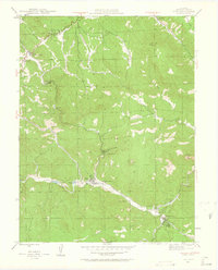
1945 Map of Pine
USGS Topo · Published 1962About this map
The North Fork South Platte River carves a deep valley through this portion of the Pike National Forest, where small canyon settlements and mountain ranches defined the local geography in the mid-1940s. The community of Pine serves as a central point along the river, linked to nearby clusters like Sphinx Park and Bryn Mawr. Further east, the confluence at Buffalo Creek marks a significant junction of waterways and local roads. High-altitude landmarks like the Cathedral Spires and Riley Peak loom over the drainage basins, illustrating the verticality that constrained early development to narrow gulches and canyon floors.
Find a feature on this map
34 named features on this map. Tap any name to fly to it.
Don’t see what you’re looking for? This feature index may not catch every label — zoom into the map to look around manually.
Map Details
Editions of this 1945 Pine Map
4 editions found
Other maps of this area

1893 · Platte Canyon
USGS Topo · 1:125,000

1899 · West Denver
USGS Topo · 1:125,000

1945 · Indian Hills
USGS Topo · 1:31,680

1945 · Platte Canyon
USGS Topo · 1:24,000

1945 · Pine
USGS Topo · 1:24,000

1945 · Bailey
USGS Topo · 1:24,000

1948 · Pine
USGS Topo · 1:24,000

1948 · Platte Canyon
USGS Topo · 1:24,000

1949 · Bailey
USGS Topo · 1:24,000

1953 · Denver
USGS Topo · 1:250,000