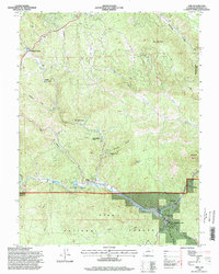
1994 Map of Pine
USGS Topo · Published 1998About this map
The North Fork South Platte River carves through the heart of this terrain, anchoring a network of canyons and settlements within the Pike National Forest. In the mid-1990s, the mountain communities of Pine and Buffalo Creek served as focal points for local life, with the latter housing the Buffalo Creek Work Center. The area is defined by its dramatic relief, including the prominent granite forms of the Cathedral Spires and Banner Peak. Evidence of local infrastructure is seen in the Elk Creek Fire Station and various small residential pockets like Sphinx Park and Indian Springs Village. A legacy of resource extraction is marked by a Quarry and Gravel Pit, while the rugged north is home to Reynolds Ranch County Park. This map provides a detailed view of the rural landscape before major 21st-century environmental shifts, capturing a time when small hamlets were still connected by winding gulches and secondary mountain roads.
Find a feature on this map
35 named features on this map. Tap any name to fly to it.
Don’t see what you’re looking for? This feature index may not catch every label — zoom into the map to look around manually.
Map Details
Editions of this 1994 Pine Map
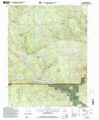
2 editions found
Other maps of this area

1893 · Platte Canyon
USGS Topo · 1:125,000

1899 · West Denver
USGS Topo · 1:125,000

1945 · Indian Hills
USGS Topo · 1:31,680

1945 · Platte Canyon
USGS Topo · 1:24,000

1945 · Pine
USGS Topo · 1:24,000

1945 · Bailey
USGS Topo · 1:24,000

1948 · Pine
USGS Topo · 1:24,000

1948 · Platte Canyon
USGS Topo · 1:24,000

1949 · Bailey
USGS Topo · 1:24,000

1953 · Denver
USGS Topo · 1:250,000