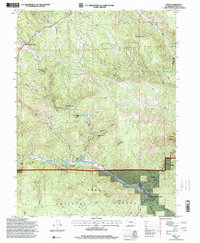
1994 Map of Pine
USGS Topo · Published 2001About this map
Pike National Forest dominates this mountain landscape, where the North Fork South Platte River carves through the southern half of the quadrangle. Small clusters of residential development and summer cabins are visible at Sphinx Park, Buffalo Creek, and Pine, reflecting the area's mid-century transition toward recreation and mountain living. The presence of the Elk Creek Fire Sta and the Buffalo Creek Work Center underscores the administrative and safety infrastructure required for managing these forested tracts.
Find a feature on this map
38 named features on this map. Tap any name to fly to it.
Don’t see what you’re looking for? This feature index may not catch every label — zoom into the map to look around manually.
Map Details
Editions of this 1994 Pine Map
2 editions found
Other maps of this area

1893 · Platte Canyon
USGS Topo · 1:125,000

1899 · West Denver
USGS Topo · 1:125,000

1945 · Indian Hills
USGS Topo · 1:31,680

1945 · Platte Canyon
USGS Topo · 1:24,000

1945 · Pine
USGS Topo · 1:24,000

1945 · Bailey
USGS Topo · 1:24,000

1948 · Pine
USGS Topo · 1:24,000

1948 · Platte Canyon
USGS Topo · 1:24,000

1949 · Bailey
USGS Topo · 1:24,000

1953 · Denver
USGS Topo · 1:250,000