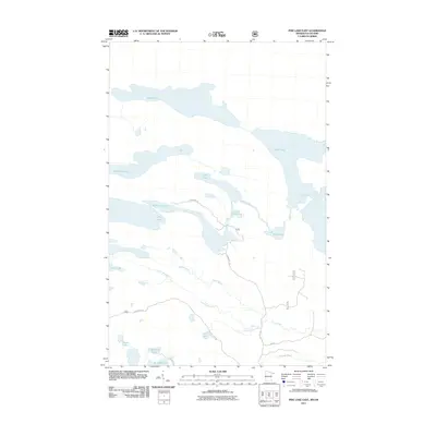
2011 Map of Pine Lake East
USGS Topo · Published 2011About this map
Moose Lake and Fowl Lake dominate the northern landscape of this borderland survey, illustrating the intricate network of waterways defining the boundary between Minnesota and Ontario. The Pigeon River serves as a critical connector in a drainage system that includes Royal Lake and the meandering Stump River. This region, characterized by its glacial hydrology, is navigated primarily by the historic Arrowhead Trl, which provides access to McFarland Lake and Little John Lake. The distribution of smaller bodies of water like Loft Lake and Fault Lake highlights the complex, water-heavy geography typical of the North Shore backcountry. For researchers, the map traces the early 21st-century footprint of remote roads such as Shoe Lake Rd and Fullerton Rd as they move through this lake-studded territory.
Find a feature on this map
22 named features on this map. Tap any name to fly to it.
Don’t see what you’re looking for? This feature index may not catch every label — zoom into the map to look around manually.
Map Details
Editions of this 2011 Pine Lake East Map
This is the sole edition of this map. No revisions or reprints were ever made.
Other maps of this area

1954 · Two Harbors
USGS Topo · 1:250,000

1957 · Two Harbors
USGS Topo · 1:250,000

1957 · Quetico
USGS Topo · 1:250,000

1958 · Two Harbors
USGS Topo · 1:250,000

1958 · Hancock
USGS Topo · 1:250,000

1959 · Northern Light Lake
USGS Topo · 1:24,000

1959 · Pine Lake East
USGS Topo · 1:24,000

1959 · Tom Lake
USGS Topo · 1:24,000

1959 · Pine Lake West
USGS Topo · 1:24,000

1959 · Fort William
USGS Topo · 1:250,000