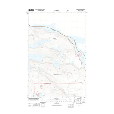
2013 Map of Pine Lake East
USGS Topo · Published 2013About this map
The international border between Canada and the United States cuts through the northern reaches of this wilderness area, following the chain of lakes in Cook County. Within the Superior National Forest, the landscape is defined by its complex hydrology, where McFarland Lake serves as a central hub for the surrounding waters. A network of primary access routes, including Arrowhead Trl and Shoe Lake Rd, navigate the dense terrain, connecting smaller water bodies like Little John Lake and John Lake. The southeastern portion of the map is marked by the distinct passage of the Royal River as it flows into Royal Lake, eventually reaching the larger expanse of South Fowl Lake. This survey illustrates the intricate drainage patterns of the Boundary Waters region, tracing the paths of Stump River and Portage Brook through these protected public lands.
Find a feature on this map
27 named features on this map. Tap any name to fly to it.
Don’t see what you’re looking for? This feature index may not catch every label — zoom into the map to look around manually.
Map Details
Editions of this 2013 Pine Lake East Map
This is the sole edition of this map. No revisions or reprints were ever made.
Other maps of this area

1954 · Two Harbors
USGS Topo · 1:250,000

1957 · Two Harbors
USGS Topo · 1:250,000

1957 · Quetico
USGS Topo · 1:250,000

1958 · Two Harbors
USGS Topo · 1:250,000

1958 · Hancock
USGS Topo · 1:250,000

1959 · Northern Light Lake
USGS Topo · 1:24,000

1959 · Pine Lake East
USGS Topo · 1:24,000

1959 · Tom Lake
USGS Topo · 1:24,000

1959 · Pine Lake West
USGS Topo · 1:24,000

1959 · Fort William
USGS Topo · 1:250,000