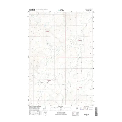
2017 Map of Pine Lake
USGS Topo · Published 2017About this map
Tapiola serves as the primary settlement hub for this portion of the Upper Peninsula, where the landscape is defined by an intricate network of waterways including the Sante River and Pine Lake. The map reveals a rural infrastructure built around historical land divisions and local family legacy, evidenced by the numerous named local roads like Peltola Rd and Maki Rd that crisscross the wetlands and timbered tracts. The presence of Elo Cem near the intersection of Cemetery Rd and Askel Rd provides a specific point of interest for genealogists tracing the Finnish heritage common to this region of Houghton County. While modern in its data collection, the map preserves the names of earlier industrial footprints, such as Challenge Mine Rd, which points to the area's copper mining history. The hydrological complexity is striking, with the N Br Otter River and E Br Otter River draining the eastern half of the quadrangle.
Find a feature on this map
42 named features on this map. Tap any name to fly to it.
Don’t see what you’re looking for? This feature index may not catch every label — zoom into the map to look around manually.
Map Details
Editions of this 2017 Pine Lake Map
This is the sole edition of this map. No revisions or reprints were ever made.
Other maps of this area

1915 · Houghton
USGS Topo · 1:62,500

1946 · Chassell
USGS Topo · 1:24,000

1946 · South Range
USGS Topo · 1:24,000

1948 · South Range
USGS Topo · 1:24,000

1948 · Chassell
USGS Topo · 1:24,000

1954 · Graveraet River
USGS Topo · 1:24,000

1954 · Pelkie
USGS Topo · 1:62,500

1954 · Winona
USGS Topo · 1:62,500

1954 · Houghton
USGS Topo · 1:62,500

1958 · Hancock
USGS Topo · 1:250,000