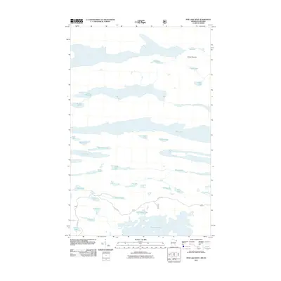
2011 Map of Pine Lake West
USGS Topo · Published 2011About this map
Moose Mountain dominates the northern landscape of this borderlands region, overlooking a complex network of glacial lakes and waterways in the early 21st century. The map illustrates a transitional wilderness where the Crocodile River and Stump River connect numerous bodies of water, including the elongated Pine Lake and West Pike Lake. Human infrastructure is sparse, represented primarily by Shoe Lake Rd winding through the southern portion of the quadrangle. The naming conventions of the smaller lakes—such as Bean Lake, Carrot Lake, Potato Lake, and Tomato Lake—suggest a whimsical or systematic approach to cataloging the region's many interior basins. Larger waters like Greenwood Lake and North Shady Lake anchor the southern boundary, providing a detailed look at the hydrology of this remote area.
Find a feature on this map
34 named features on this map. Tap any name to fly to it.
Don’t see what you’re looking for? This feature index may not catch every label — zoom into the map to look around manually.
Map Details
Editions of this 2011 Pine Lake West Map
This is the sole edition of this map. No revisions or reprints were ever made.
Other maps of this area

1954 · Two Harbors
USGS Topo · 1:250,000

1957 · Two Harbors
USGS Topo · 1:250,000

1957 · Quetico
USGS Topo · 1:250,000

1958 · Two Harbors
USGS Topo · 1:250,000

1959 · Northern Light Lake
USGS Topo · 1:24,000

1959 · Pine Mountain
USGS Topo · 1:24,000

1959 · Pine Lake East
USGS Topo · 1:24,000

1959 · Tom Lake
USGS Topo · 1:24,000

1959 · Pine Lake West
USGS Topo · 1:24,000

1959 · Crocodile Lake
USGS Topo · 1:24,000