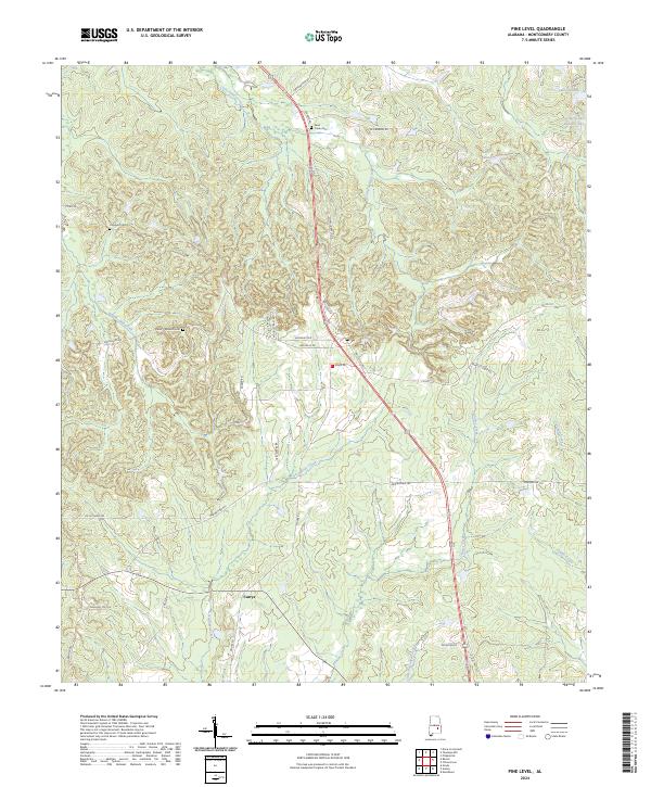
2024 Map of Pine Level
USGS Topo · Published 2024About this map
Olustee Creek and its various tributaries, including Greenbrier Creek and Baskins Mill Creek, carve a complex drainage pattern across this rural Montgomery County landscape. The settlement of Currys sits in the southwest, while the northern reaches are dotted with local water bodies such as Lake Ben, Sellers Ponds, and Sellers Lake Number Two. This modern survey illustrates the persistent rural character of the region, where the road network follows the undulating terrain between creek bottoms.
Find a feature on this map
44 named features on this map. Tap any name to fly to it.
Don’t see what you’re looking for? This feature index may not catch every label — zoom into the map to look around manually.
Map Details
Editions of this 2024 Pine Level Map
This is the sole edition of this map. No revisions or reprints were ever made.
Other maps of this area

1953 · Montgomery
USGS Topo · 1:250,000

1953 · Andalusia
USGS Topo · 1:250,000

1953 · Dothan
USGS Topo · 1:250,000

1954 · Dothan
USGS Topo · 1:250,000

1955 · Dothan
USGS Topo · 1:250,000

1955 · Phenix City
USGS Topo · 1:250,000

1956 · Montgomery
USGS Topo · 1:250,000

1957 · Phenix City
USGS Topo · 1:250,000

1957 · Montgomery
USGS Topo · 1:250,000

1957 · Andalusia
USGS Topo · 1:250,000