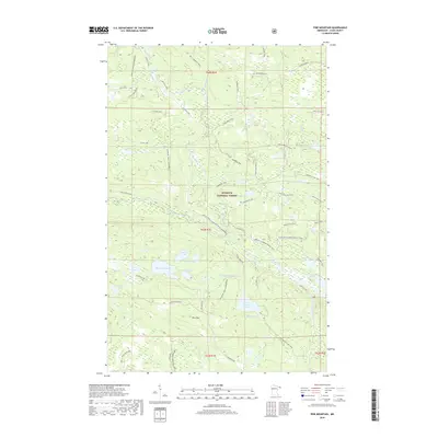
2019 Map of Pine Mountain
USGS Topo · Published 2019About this map
The Superior National Forest dominates this northern wilderness landscape, where a dense network of water bodies and ancient travel routes defines the geography. High ground at Pine Mountain and Blueberry Hill overlooks a complex system of drainage, including the Brule River and its southern fork. The map traces the legendary Gunflint Trail and the historic Gunflint to Grand Portage Trail, highlighting the long-standing importance of this corridor for regional transit and connectivity. Numerous lakes, such as Northern Light Lake, Musquash Lake, and Pine Mountain Lake, are linked by smaller streams and forest tracks like the Swamper Trail and Old Greenwood spur roads. This 2019 survey captures the area's intricate hydrography and the preserved forest service infrastructure that supports the region's recreation and conservation efforts.
Find a feature on this map
59 named features on this map. Tap any name to fly to it.
Don’t see what you’re looking for? This feature index may not catch every label — zoom into the map to look around manually.
Map Details
Editions of this 2019 Pine Mountain Map
This is the sole edition of this map. No revisions or reprints were ever made.
Other maps of this area

1954 · Two Harbors
USGS Topo · 1:250,000

1957 · Two Harbors
USGS Topo · 1:250,000

1957 · Quetico
USGS Topo · 1:250,000

1958 · Two Harbors
USGS Topo · 1:250,000

1959 · Northern Light Lake
USGS Topo · 1:24,000

1959 · Pine Mountain
USGS Topo · 1:24,000

1959 · Lima Mountain
USGS Topo · 1:24,000

1959 · Hungry Jack Lake
USGS Topo · 1:24,000

1959 · Pine Lake West
USGS Topo · 1:24,000

1959 · Crocodile Lake
USGS Topo · 1:24,000