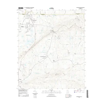
2014 Map of Pine Mountain
USGS Topo · Published 2014About this map
Callaway Gardens and the expansive resort landscape define the western edge of this Harris County survey, centered on the diverse water bodies of the Pine Mountain ridge. From Robin Lake to the avian-named chain of Mockingbird Lake and Whippoorwill Lake, the area's development for recreation is clearly established. The ridge itself, marked by Oak Mtn and Pine Mtn, is traversed by Ga-190 and the Franklin D Roosevelt Memorial Bridge, reflecting the local historical ties to the 32nd President.
Find a feature on this map
84 named features on this map. Tap any name to fly to it.
Don’t see what you’re looking for? This feature index may not catch every label — zoom into the map to look around manually.
Map Details
Editions of this 2014 Pine Mountain Map
This is the sole edition of this map. No revisions or reprints were ever made.
Other maps of this area

1907 · Talbotton
USGS Topo · 1:125,000

1934 · Warm Springs
USGS Topo · 1:62,500

1936 · Warm Springs
USGS Topo · 1:62,500

1950 · Mulberry Grove
USGS Topo · 1:24,000

1950 · Waverly Hall
USGS Topo · 1:24,000

1950 · Cataula
USGS Topo · 1:24,000

1950 · Talbotton
USGS Topo · 1:62,500

1950 · Ellerslie
USGS Topo · 1:62,500
1955 · Mulberry Grove
USGS Topo · 1:24,000
1955 · Waverly Hall
USGS Topo · 1:24,000
Featured Places
- Pine Mountain, GA
- Hamilton, GA
- Pine Mountain Valley, GA
- Champion Crossroad, GA
- Mountainbrook, Pine Mountain