
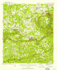
1950 Map of Ellerslie
USGS Topo · Published 1955About this map
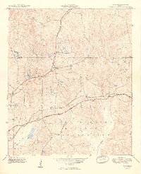
Fort Benning Military Reservation dominates the southeastern quadrant of this West Georgia landscape, marking a significant military footprint alongside the growing urban edge of Columbus and Bibb City. The survey captures the transition from rural agricultural land to early suburban and industrial expansion, evidenced by the presence of the Muscogee County Airport and the Columbus Speedway Racetrack. Transportation networks are well-defined by the Central of Georgia Railroad and Southern Railway, which link smaller communities like Cataula, Ellerslie, and Waverly Hall.
Find a feature on this map
73 named features on this map. Tap any name to fly to it.
Don’t see what you’re looking for? This feature index may not catch every label — zoom into the map to look around manually.
Map Details
Editions of this 1950 Ellerslie Map
This is the sole edition of this map. No revisions or reprints were ever made.
Other maps of this area

1907 · Talbotton
USGS Topo · 1:125,000

1907 · Opelika
USGS Topo · 1:125,000
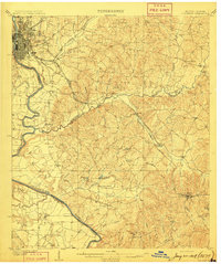
1908 · Columbus
USGS Topo · 1:62,500

1909 · Opelika
USGS Topo · 1:125,000
1914 · Seale
USGS Topo · 1:62,500

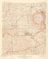
1929 · Columbus
USGS Topo · 1:48,000
1934 · Warm Springs
USGS Topo · 1:62,500
1936 · Warm Springs
USGS Topo · 1:62,500

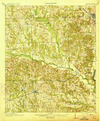
1947 · Columbus
USGS Topo · 1:62,500
1949 · Midland
USGS Topo · 1:24,000