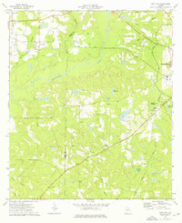
1974 Map of Pine Park
USGS Topo · Published 1976About this map
The Ochlockonee River defines the central landscape of this South Georgia region, where the Seaboard Coast Line railroad cuts across the terrain near the settlement of Pine Park. In the mid-1970s, this area on the Grady Co Thomas Co line was characterized by an intricate network of small creeks like Lees Creek and Barnetts Creek that feed into the river's meandering path.
Find a feature on this map
32 named features on this map. Tap any name to fly to it.
Don’t see what you’re looking for? This feature index may not catch every label — zoom into the map to look around manually.
Map Details
Editions of this 1974 Pine Park Map
This is the sole edition of this map. No revisions or reprints were ever made.
Other maps of this area

1954 · Valdosta
USGS Topo · 1:250,000

1954 · Tallahassee
USGS Topo · 1:250,000

1956 · Cairo
USGS Topo · 1:62,500

1956 · Metcalf
USGS Topo · 1:24,000

1957 · Beachton
USGS Topo · 1:24,000

1957 · Miccosukee NE
USGS Topo · 1:24,000

1957 · Thomasville
USGS Topo · 1:62,500

1958 · Valdosta
USGS Topo · 1:250,000

1959 · Tallahassee
USGS Topo · 1:250,000

1959 · Valdosta
USGS Topo · 1:250,000