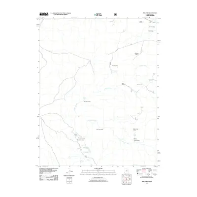
2011 Map of Pine Park
USGS Topo · Published 2011About this map
Hamblin Ranch serves as a lone human landmark in this section of Washington County, Utah, where the landscape is defined by its network of canyons and crucial water sources. The map highlights the drainage systems of Headwaters Wash and East Fork Beaver Dam Wash, illustrating how water management shaped this arid region through features like Schroeder Lake, held by Schroeder Dam, and several upland reservoirs including Crestline Reservoir and Pine Mountain Reservoir.
Find a feature on this map
31 named features on this map. Tap any name to fly to it.
Don’t see what you’re looking for? This feature index may not catch every label — zoom into the map to look around manually.
Map Details
Editions of this 2011 Pine Park Map
This is the sole edition of this map. No revisions or reprints were ever made.
Other maps of this area

1885 · St. George
USGS Topo · 1:250,000

1885 · Pioche
USGS Topo · 1:250,000

1886 · Pioche
USGS Topo · 1:250,000

1891 · St. George
USGS Topo · 1:250,000

1953 · Cedar City
USGS Topo · 1:250,000

1954 · Caliente
USGS Topo · 1:250,000

1958 · Cedar City
USGS Topo · 1:250,000

1958 · Docs Pass
USGS Topo · 1:24,000

1959 · Caliente
USGS Topo · 1:250,000

1962 · Cedar City
USGS Topo · 1:250,000