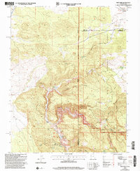
2002 Map of Pine Park
USGS Topo · Published 2005About this map
Beaver Dam Wash State Park and the surrounding Dixie National Forest dominate this arid landscape along the high-desert borderlands. The terrain is defined by complex drainage systems and isolated water sources, including Pine Mountain Reservoir, Wheatgrass Reservoir, and the deep incisions of Beaver Dam Wash. In a region where water dictated survival and settlement, the presence of Hamblin Ranch marks a notable point of human activity amidst the canyons.
Find a feature on this map
36 named features on this map. Tap any name to fly to it.
Don’t see what you’re looking for? This feature index may not catch every label — zoom into the map to look around manually.
Map Details
Editions of this 2002 Pine Park Map
This is the sole edition of this map. No revisions or reprints were ever made.
Other maps of this area

1885 · St. George
USGS Topo · 1:250,000

1885 · Pioche
USGS Topo · 1:250,000

1886 · Pioche
USGS Topo · 1:250,000

1891 · St. George
USGS Topo · 1:250,000

1953 · Cedar City
USGS Topo · 1:250,000

1954 · Caliente
USGS Topo · 1:250,000

1958 · Cedar City
USGS Topo · 1:250,000

1958 · Docs Pass
USGS Topo · 1:24,000

1959 · Caliente
USGS Topo · 1:250,000

1962 · Cedar City
USGS Topo · 1:250,000