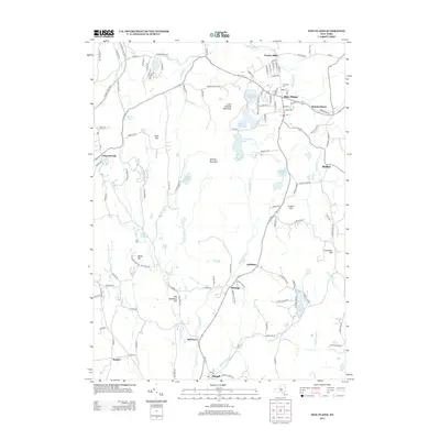
2013 Map of Pine Plains
USGS Topo · Published 2013About this map
Pine Plains serves as the primary hub of this landscape, situated near the headwaters of the Shekomeko Cr. The settlement pattern here reflects the agricultural and milling history of Dutchess County, with smaller hamlets like Pachin Mills and Hammertown spaced along established travel routes. To the west, the prominent elevation of Stissing Mountain and Little Stissing Mountain creates a natural barrier, around which a network of glacial lakes and ponds has formed. This hydrologic system includes Twin Island Lake, Stissing Pond, and the ecologically significant Thompson Pond, which feed into the southward-flowing Wappinger Cr. Genealogists will find the Evergreen Cem north of the village center, while researchers of rural commerce can trace the early road networks connecting Lafayetteville, Attlebury, and Bangall. The presence of MLC Farm and numerous named hills like Shelly Hill and Conklin Hill suggests a long-standing continuity of land use in this part of New York.
Find a feature on this map
128 named features on this map. Tap any name to fly to it.
Don’t see what you’re looking for? This feature index may not catch every label — zoom into the map to look around manually.
Map Details
Editions of this 2013 Pine Plains Map
This is the sole edition of this map. No revisions or reprints were ever made.
Other maps of this area

1895 · Catskill
USGS Topo · 1:62,500

1898 · Rhinebeck
USGS Topo · 1:62,500

1899 · Millbrook
USGS Topo · 1:62,500

1902 · Millbrook
USGS Topo · 1:62,500

1902 · Copake
USGS Topo · 1:62,500

1904 · Copake
USGS Topo · 1:62,500

1934 · Rhinebeck
USGS Topo · 1:48,000

1934 · Catskill
USGS Topo · 1:62,500

1938 · Catskill
USGS Topo · 1:62,500

1939 · Rhinebeck
USGS Topo · 1:62,500