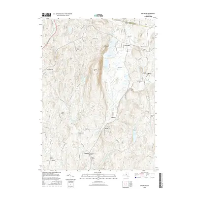
2016 Map of Pine Plains
USGS Topo · Published 2016About this map
Stissing Mtn and Little Stissing Mtn dominate the central corridor of this Dutchess County landscape, where the valley floor is punctuated by a string of water bodies including Thompson Pond, Stissing Pond, and Twin Island Lake. This area reflects a classic Hudson Valley settlement pattern, with small communities like Pine Plains, Hammertown, and Pachin Mills positioned along the drainage of Wappinger Cr and Shekomeko Cr.
Find a feature on this map
104 named features on this map. Tap any name to fly to it.
Don’t see what you’re looking for? This feature index may not catch every label — zoom into the map to look around manually.
Map Details
Editions of this 2016 Pine Plains Map
This is the sole edition of this map. No revisions or reprints were ever made.
Other maps of this area

1895 · Catskill
USGS Topo · 1:62,500

1898 · Rhinebeck
USGS Topo · 1:62,500

1899 · Millbrook
USGS Topo · 1:62,500

1902 · Millbrook
USGS Topo · 1:62,500

1902 · Copake
USGS Topo · 1:62,500

1904 · Copake
USGS Topo · 1:62,500

1934 · Rhinebeck
USGS Topo · 1:48,000

1934 · Catskill
USGS Topo · 1:62,500

1938 · Catskill
USGS Topo · 1:62,500

1939 · Rhinebeck
USGS Topo · 1:62,500