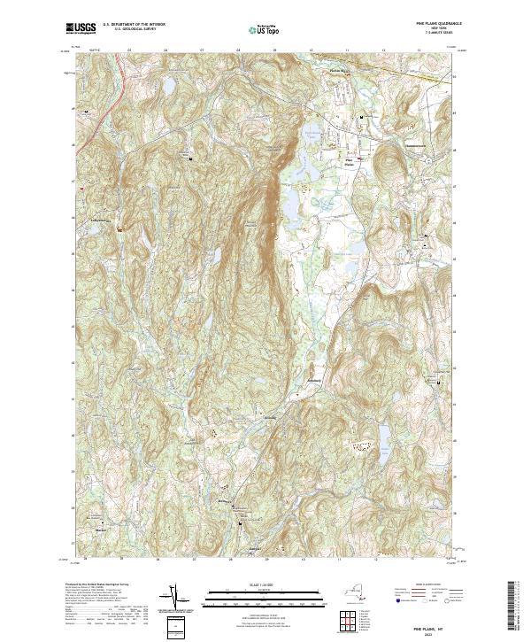
2023 Map of Pine Plains
USGS Topo · Published 2023About this map
Stissing Mountain dominates the central topography of this modern survey, flanked by a complex drainage system of lakes and creeks in northern Dutchess County. The settlement patterns reflect a legacy of localized industry and rural centers, from the waters of Twin Island Lake near Pine Plains to the namesake mills of Pachin Mills along the northern border. Further south, the landscape is dotted with small historical nodes like Stissing and Bangall, the latter featuring the Bangall Baptist Church Cem Number 1 and its second counterpart nearby.
Find a feature on this map
113 named features on this map. Tap any name to fly to it.
Don’t see what you’re looking for? This feature index may not catch every label — zoom into the map to look around manually.
Map Details
Editions of this 2023 Pine Plains Map
This is the sole edition of this map. No revisions or reprints were ever made.
Other maps of this area

1895 · Catskill
USGS Topo · 1:62,500

1898 · Rhinebeck
USGS Topo · 1:62,500

1899 · Millbrook
USGS Topo · 1:62,500

1902 · Millbrook
USGS Topo · 1:62,500

1902 · Copake
USGS Topo · 1:62,500

1904 · Copake
USGS Topo · 1:62,500

1934 · Rhinebeck
USGS Topo · 1:48,000

1934 · Catskill
USGS Topo · 1:62,500

1938 · Catskill
USGS Topo · 1:62,500

1939 · Rhinebeck
USGS Topo · 1:62,500