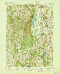
1948 Map of Pine Plains
USGS Topo · Published 1948About this map
Stissing Mountain dominates the center of this northern Dutchess County landscape, creating a dramatic physical divide between the eastern agricultural valleys and the western hills. In the late 1940s, the area remained deeply rural, defined by a network of small hamlets and local landmarks that speak to an earlier era of self-sufficiency. Settlement clusters like Hammertown, Pachin Mills, and Lafayetteville are shown at their mid-century extent, alongside several rural schoolhouses such as Hunns Lake Sch and Bear Market Sch. The map reveals a transition in settlement patterns, noting both the established hub of Pine Plains and the location of Old Attlebury, providing a clear view of how local roads and communities evolved around water features like Hunns Lake and the winding Wappinger Creek.
Find a feature on this map
38 named features on this map. Tap any name to fly to it.
Don’t see what you’re looking for? This feature index may not catch every label — zoom into the map to look around manually.
Map Details
Editions of this 1948 Pine Plains Map
This is the sole edition of this map. No revisions or reprints were ever made.
Other maps of this area

1895 · Catskill
USGS Topo · 1:62,500

1898 · Rhinebeck
USGS Topo · 1:62,500

1899 · Millbrook
USGS Topo · 1:62,500

1902 · Millbrook
USGS Topo · 1:62,500

1902 · Copake
USGS Topo · 1:62,500

1904 · Copake
USGS Topo · 1:62,500

1934 · Rhinebeck
USGS Topo · 1:48,000

1934 · Catskill
USGS Topo · 1:62,500

1938 · Catskill
USGS Topo · 1:62,500

1939 · Rhinebeck
USGS Topo · 1:62,500