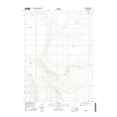
2015 Map of Pine Ridge
USGS Topo · Published 2015About this map
The Medicine Bow River carves a winding path through this high-altitude landscape in Carbon County, Wyoming. The terrain is characterized by a series of prominent rises and flats, notably the eponymous Pine Ridge and nearby Indian Hill. This area is a network of water management features, including the Vandiver Ditch and Thornton Ditch, which redirect water across open expanses like Spade Flats and Horne Flats. Evidence of early 21st-century rural infrastructure is visible along E Allen Rd S and CR-320, while natural landmarks like Alligator Rock and Bible Rock provide distinctive points of reference for local historians. High-desert water sources such as Cronberg Spring, East Allen Lake, and Horne Lake are critical features in this arid environment, illustrating the complex relationship between the topography and the region's limited water supply.
Find a feature on this map
21 named features on this map. Tap any name to fly to it.
Don’t see what you’re looking for? This feature index may not catch every label — zoom into the map to look around manually.
Map Details
Editions of this 2015 Pine Ridge Map
This is the sole edition of this map. No revisions or reprints were ever made.
Other maps of this area

1914 · Saddleback Hills
USGS Topo · 1:62,500

1915 · Como Ridge
USGS Topo · 1:48,000

1918 · Como Ridge
USGS Topo · 1:62,500

1921 · Saddleback Hills
USGS Topo · 1:62,500

1954 · Rawlins
USGS Topo · 1:250,000

1958 · Rawlins
USGS Topo · 1:250,000

1958 · Mc Fadden
USGS Topo · 1:24,000
1958 · Pierce Reservoir
USGS Topo · 1:24,000

1958 · T L Ranch
USGS Topo · 1:24,000

1962 · Rawlins
USGS Topo · 1:250,000