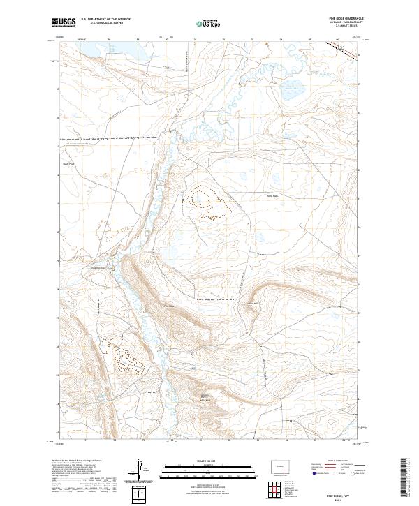
2021 Map of Pine Ridge
USGS Topo · Published 2021About this map
The Medicine Bow River winds through this high-altitude landscape in Carbon County, defining the drainage patterns for a series of basins and flats. Settlers and ranchers in this corner of Wyoming utilized an extensive network of irrigation improvements to manage the water, including the Vandiver Ditch in the north and the Thornton Ditch in the southeast. These man-made channels support the grazing lands of Spade Flats and Horne Flats, which sit in the shadow of prominent topographical markers.
Find a feature on this map
25 named features on this map. Tap any name to fly to it.
Don’t see what you’re looking for? This feature index may not catch every label — zoom into the map to look around manually.
Map Details
Editions of this 2021 Pine Ridge Map
This is the sole edition of this map. No revisions or reprints were ever made.
Other maps of this area

1914 · Saddleback Hills
USGS Topo · 1:62,500

1915 · Como Ridge
USGS Topo · 1:48,000

1918 · Como Ridge
USGS Topo · 1:62,500

1921 · Saddleback Hills
USGS Topo · 1:62,500

1954 · Rawlins
USGS Topo · 1:250,000

1958 · Rawlins
USGS Topo · 1:250,000

1958 · Mc Fadden
USGS Topo · 1:24,000
1958 · Pierce Reservoir
USGS Topo · 1:24,000

1958 · T L Ranch
USGS Topo · 1:24,000

1962 · Rawlins
USGS Topo · 1:250,000