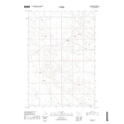
2017 Map of Pine Spring
USGS Topo · Published 2017About this map
Jumpoff Divide forms a prominent topographic spine through this section of Harding County, separating the drainages of the northern plains. The landscape is defined by its water sources, including Buffalo Springs and the Cundy Reservoir, which provided critical focal points for ranching and land use in this arid region of South Dakota. The drainage patterns are clearly delineated by Antelope Cr to the north and Pine Spring Cr to the east, while The Jumpoff marks a significant break in the local elevation. A sparse network of roads, including Bullock Rd and Harding Rd, connects these remote land sections, illustrating the expansive nature of the High Plains interior. This survey captures the essential hydrologic and geographic markers used by generations to navigate the open range between Pine Draw and Valley Cr.
Find a feature on this map
21 named features on this map. Tap any name to fly to it.
Don’t see what you’re looking for? This feature index may not catch every label — zoom into the map to look around manually.
Map Details
Editions of this 2017 Pine Spring Map
This is the sole edition of this map. No revisions or reprints were ever made.
Other maps of this area

1935 · Harding
USGS Topo · 1:125,000

1935 · Buffalo
USGS Topo · 1:125,000

1954 · Lemmon
USGS Topo · 1:250,000

1957 · Lemmon
USGS Topo · 1:250,000
1971 · Lahti Butte
USGS Topo · 1:24,000

1971 · Saddle Butte
USGS Topo · 1:24,000

1973 · Bog Creek
USGS Topo · 1:24,000

1973 · Gallup Creek
USGS Topo · 1:24,000

1974 · Caroline Butte
USGS Topo · 1:24,000

1974 · Pine Spring
USGS Topo · 1:24,000