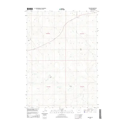
2015 Map of Pine Tree
USGS Topo · Published 2015About this map
Pine Tree anchors this Campbell County landscape, situated at a junction where the high plains meet a network of seasonal watercourses. The terrain is defined by a series of named drainages including Collins Draw, Simmons Draw, and Pine Tree Draw, which carve through the high ground surrounding Pine Tree Peak. Water management is central to the area's utility, evidenced by the Middaugh Reservoir and the presence of Pine Tree Spring. The hydrology is further articulated by the meandering paths of Bates Cr and Ninemile Cr, with the latter's southern reaches identified as S Fork Ninemile Cr. This modern survey reflects the enduring character of Wyoming's ranching country, where geography is organized around named family landmarks and vital water sources in a semi-arid environment.
Find a feature on this map
16 named features on this map. Tap any name to fly to it.
Don’t see what you’re looking for? This feature index may not catch every label — zoom into the map to look around manually.
Map Details
Editions of this 2015 Pine Tree Map
This is the sole edition of this map. No revisions or reprints were ever made.
Other maps of this area

1953 · South Butte
USGS Topo · 1:24,000

1953 · Rolling Pin Ranch
USGS Topo · 1:24,000

1954 · Artesian Draw
USGS Topo · 1:24,000

1954 · Pine Tree
USGS Topo · 1:24,000

1955 · Newcastle
USGS Topo · 1:250,000

1958 · Newcastle
USGS Topo · 1:250,000

1959 · Coal Draw
USGS Topo · 1:62,500

1960 · Ross
USGS Topo · 1:62,500

1960 · Turnercrest
USGS Topo · 1:62,500

1974 · Reno Junction
USGS Topo · 1:100,000