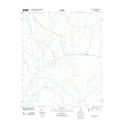
2012 Map of Pine Valley
USGS Topo · Published 2012About this map
Pine Valley serves as the primary hub in this rural landscape, which is defined by an intricate network of creeks and numerous local burial grounds. The terrain is deeply carved by waterways such as Turkey Cr, Hurricane Cr, and the appropriately named Mill Pond Br, indicating a landscape shaped by water and early small-scale industry. The placement of Bethel Cem in the north and Meggs Cem in the south, alongside others like Macedonia Cem and Tabernacle Cem, provides a detailed record of established family and community locations across the county. Roads such as Pontotoc Rd and Old Water Valley Rd connect these outlying points, tracing historical travel patterns between the region's smaller settlements and neighboring towns.
Find a feature on this map
51 named features on this map. Tap any name to fly to it.
Don’t see what you’re looking for? This feature index may not catch every label — zoom into the map to look around manually.
Map Details
Editions of this 2012 Pine Valley Map
This is the sole edition of this map. No revisions or reprints were ever made.
Other maps of this area

1953 · West Point
USGS Topo · 1:250,000

1954 · Pittsboro
USGS Topo · 1:62,500

1954 · Water Valley
USGS Topo · 1:62,500

1954 · Water Valley West
USGS Topo · 1:24,000

1955 · Water Valley
USGS Topo · 1:62,500

1955 · Coffeeville
USGS Topo · 1:62,500

1956 · Tupelo
USGS Topo · 1:250,000

1958 · Tupelo
USGS Topo · 1:250,000

1958 · West Point
USGS Topo · 1:250,000

1963 · West Point
USGS Topo · 1:250,000