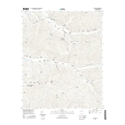
2016 Map of Pine View
USGS Topo · Published 2016About this map
Pine View and the surrounding drainage basins of the Buffalo and Tennessee Rivers define this section of Perry County. The landscape is characterized by a dense network of hollows, many bearing family names that provide significant leads for genealogical research, such as Dickson Hollow, Marshall Hollow, and Wilsdorf Hollow. These narrow valleys are often associated with small, rural cemeteries situated on higher ground or at the mouth of the hollows, including Bible Hill Cem and Choate Cem. To the west, the map reaches the shores of Kentucky Lake, where the undulating terrain meets the controlled waters of the Tennessee River. Transport in this era is dominated by winding local routes like Bunker Hill Rd and Linden Pineview Rd, which follow the natural contours of the ridges and creek beds. The drainage patterns of Spring Cr and Lick Cr further illustrate the traditional settlement orientation toward water sources and sheltered valley floors.
Find a feature on this map
97 named features on this map. Tap any name to fly to it.
Don’t see what you’re looking for? This feature index may not catch every label — zoom into the map to look around manually.
Map Details
Editions of this 2016 Pine View Map
This is the sole edition of this map. No revisions or reprints were ever made.
Other maps of this area

1936 · Pine View
USGS Topo · 1:24,000

1936 · Daniels Landing
USGS Topo · 1:24,000

1936 · Linden
USGS Topo · 1:24,000

1936 · Chestnut Grove
USGS Topo · 1:24,000

1936 · Jeannette
USGS Topo · 1:24,000

1936 · Sugar Tree
USGS Topo · 1:24,000

1936 · Lobelville
USGS Topo · 1:24,000

1936 · Perryville
USGS Topo · 1:24,000

1936 · Pope
USGS Topo · 1:24,000

1949 · Perryville
USGS Topo · 1:24,000