
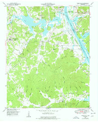
1949 Map of Perryville
USGS Topo · Published 1952About this map
Decaturville serves as a prominent highland hub on this 1940s landscape, while the Tennessee River dominates the eastern boundary, where the newly created Kentucky Lake was altering the riverfront. This era of Tennessee Valley Authority development is marked by the East Perryville Dewatering Area and complex drainage systems near Perryville. These hydrologic changes contrast with the deeply dissected hollows to the south, such as Furnace Hollow and Matted Hollow, where the terrain remains traditional and rural. Genealogists can locate several family burial grounds including Wallace Cem, Fisher Cem, and Luton Cem. Evidence of earlier industry is found at the Furnace site near Whites Creek, while community life is anchored by landmarks like Mt Lebanon Church and the Cypress Creek School. The map also preserves the locations of numerous river landings like Webbs Landing and Fishers Landing, reflecting a river-centered economy.
Find a feature on this map
81 named features on this map. Tap any name to fly to it.
Don’t see what you’re looking for? This feature index may not catch every label — zoom into the map to look around manually.
Map Details
Editions of this 1949 Perryville Map
3 editions found
Other maps of this area

1905 · Waynesboro
USGS Topo · 1:125,000

1936 · Pine View
USGS Topo · 1:24,000

1936 · Scotts Hill
USGS Topo · 1:24,000

1936 · Parsons
USGS Topo · 1:24,000

1936 · Thurman
USGS Topo · 1:24,000

1936 · Bath Springs
USGS Topo · 1:24,000

1936 · Clifton
USGS Topo · 1:24,000

1936 · Jeannette
USGS Topo · 1:24,000

1936 · Perryville
USGS Topo · 1:24,000

1936 · Pope
USGS Topo · 1:24,000