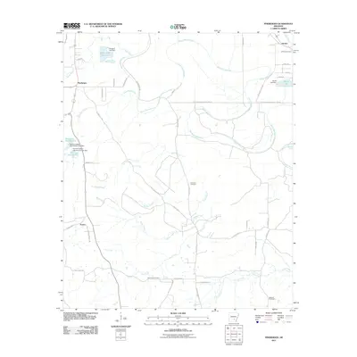
2011 Map of Pinebergen
USGS Topo · Published 2011About this map
Bayou Bartholomew snakes through this Jefferson County landscape, serving as the central hydrological spine for the small settlements of Pinebergen, Hooker, and Eunice. The 2011 survey reveals a territory defined by its winding waterways and agricultural drainage, including the distinctive Shady Oaks Reservoir held by the Taliaferro Lake Dam. The map provides significant detail for genealogists, documenting the locations of Jefferson Cemetery, Grahams Cemetery, New Owen Cemetery, and Williams Cemetery. The road network, including the Jefferson Lincoln Cnty Line Rd and Old Star City Rd, suggests a rural economy built around these creek systems. Notable water features like Rust Lake Number One and Marks Lake further illustrate the managed landscape, where numerous dams and branches such as Melton Creek and Greens Creek carve through the Arkansas terrain.
Find a feature on this map
52 named features on this map. Tap any name to fly to it.
Don’t see what you’re looking for? This feature index may not catch every label — zoom into the map to look around manually.
Map Details
Editions of this 2011 Pinebergen Map
This is the sole edition of this map. No revisions or reprints were ever made.
Other maps of this area

1935 · Feenyville
USGS Topo · 1:62,500

1935 · Noble Lake
USGS Topo · 1:62,500

1948 · Helena
USGS Topo · 1:250,000

1950 · Helena
USGS Topo · 1:250,000

1953 · Greenwood
USGS Topo · 1:250,000

1953 · El Dorado
USGS Topo · 1:250,000

1955 · Helena
USGS Topo · 1:250,000

1955 · Little Rock
USGS Topo · 1:250,000

1956 · Little Rock
USGS Topo · 1:250,000

1956 · Greenwood
USGS Topo · 1:250,000